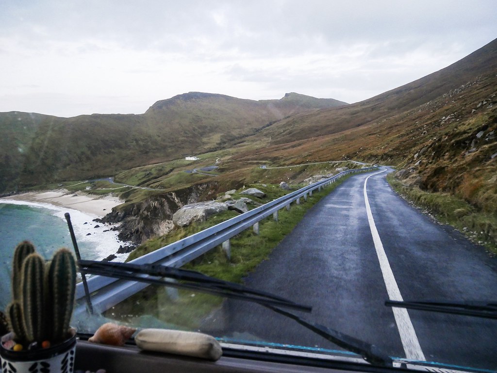
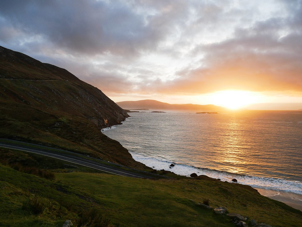
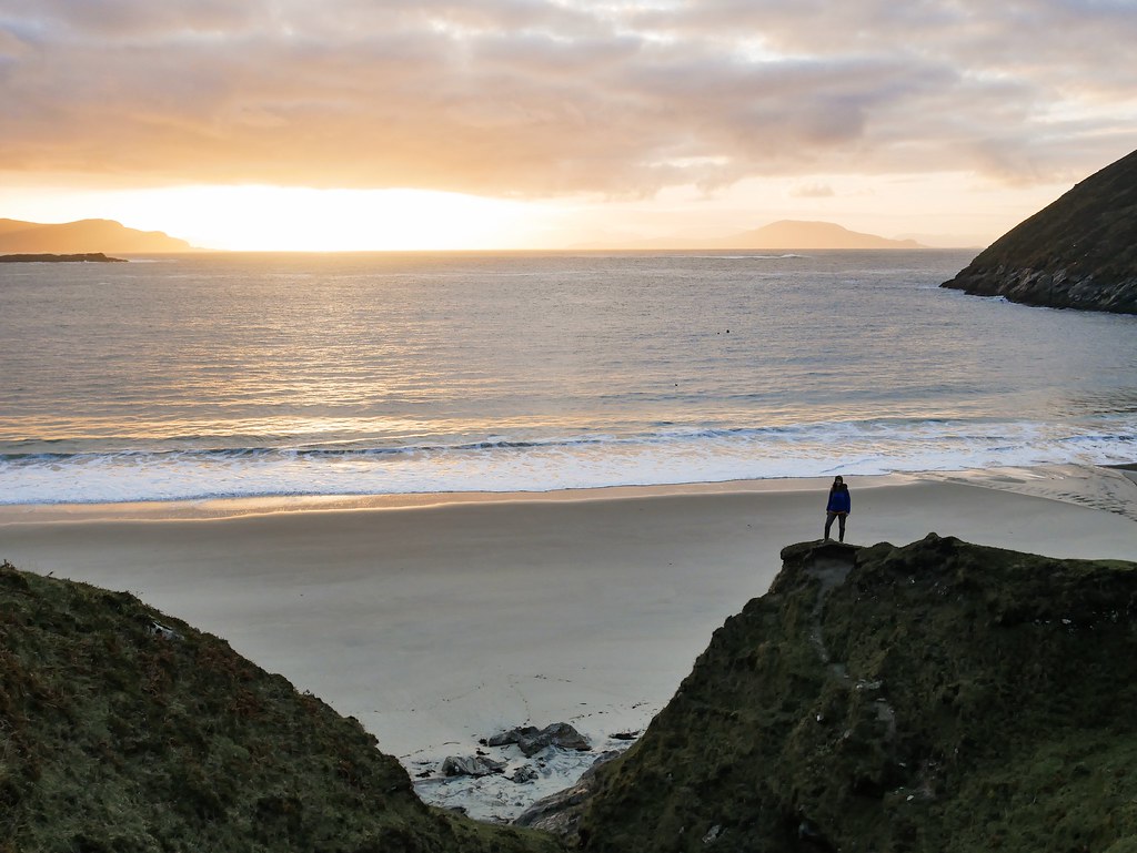
Our first two days on Achill Island were spent waiting out some very rainy weather in our campervan. On day three we finally had some good weather forecasted so we woke up before the sun and drove across the island to the end of the road at Keem Bay. The road clung to the edge of a cliff with the sea way below us and Keem beach in the distance. We were the only people there and soon after arriving the sun started to rise. It was a beautiful sunrise, the pink sun reflecting on the sea and gentle waves lapping the white sandy beach. It’s said to be one of Ireland’s best beaches and I could see why, in summer this place must be packed but in November it was just us.


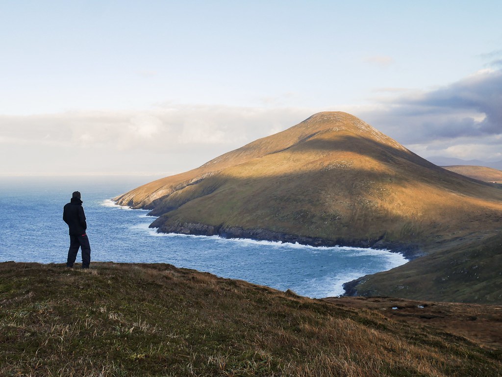
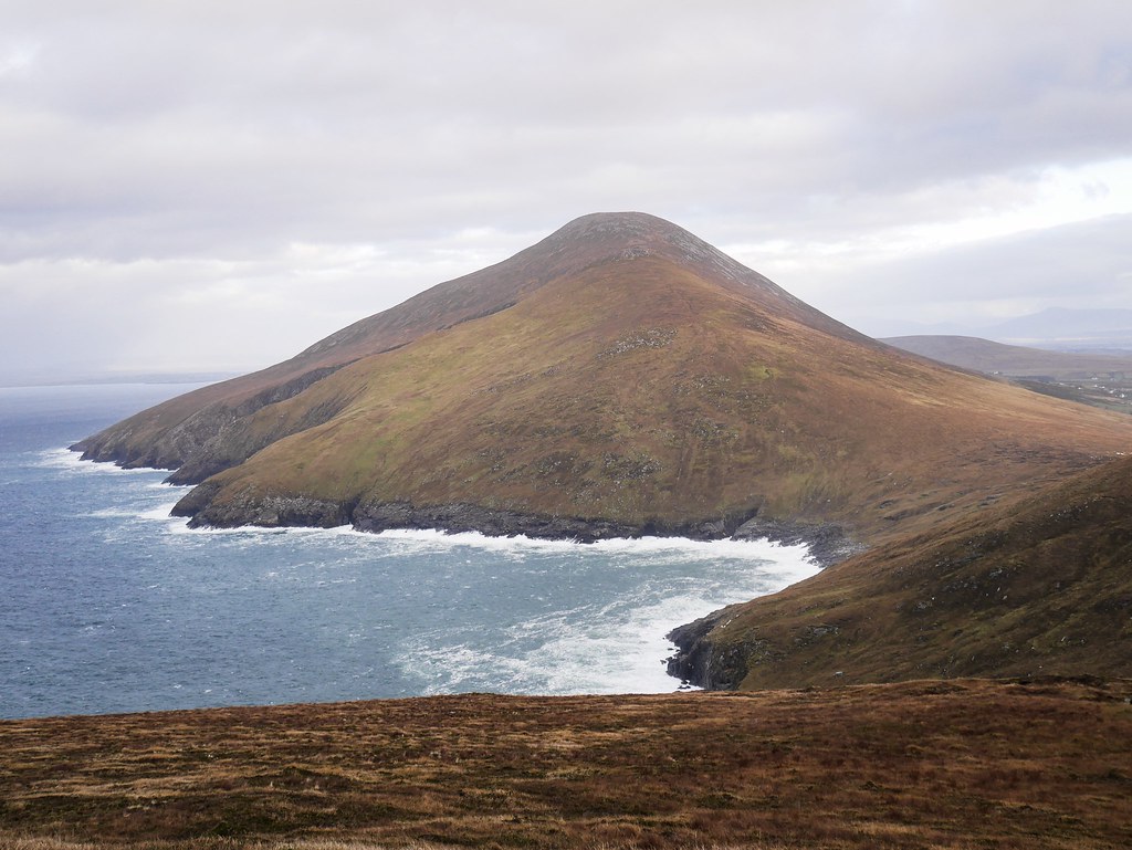
We had a long hike planned so after taking some photos of the gorgeous beach we set off up a steep hill. We were heading to the highest cliffs in Ireland and the trail led us along the western cliffs first, which were dramatic in their own right but only about 200 or 300 meters high. We enjoyed the view of the sheer drop down and then we had to descend into the valley before making our way up a very daunting looking mountain. It was covered in moorland and there were just sheep tracks to follow occasionally so the hike was very tough. In fact I couldn’t quite believe how exhausted I was going up the steep mountain-side. After a long slog we arrived on Croaghaun Mountain at 688m. This was in fact the highest point of the cliffs and it led us to question what the difference was between a mountain right on the coast and a cliff.


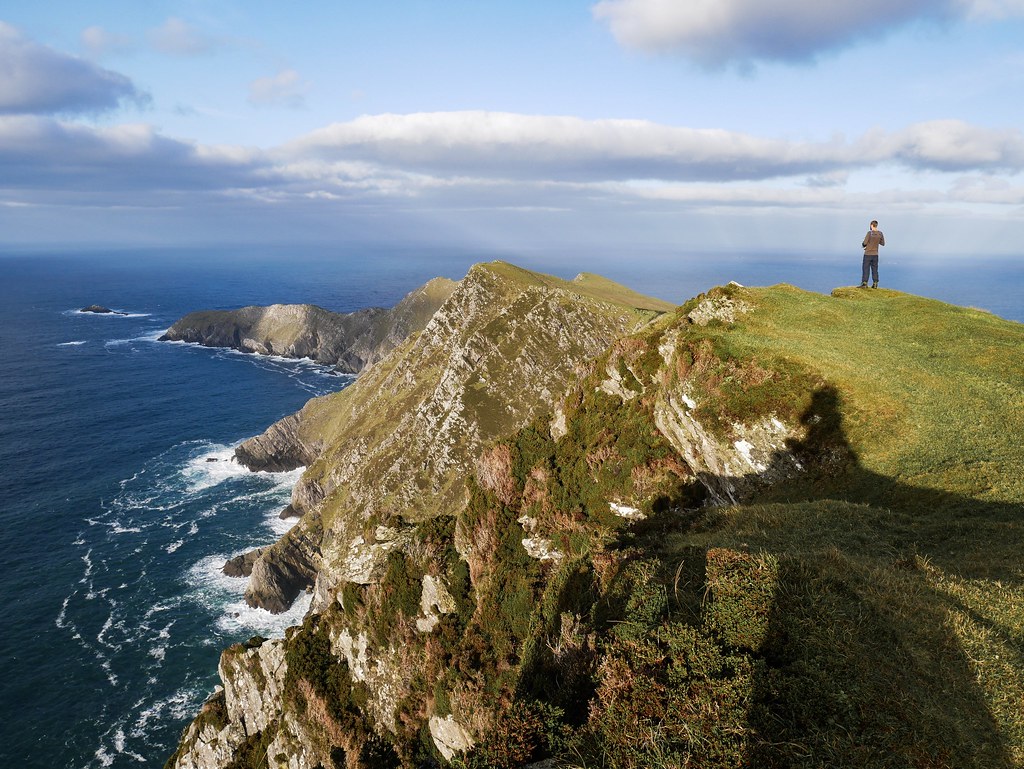


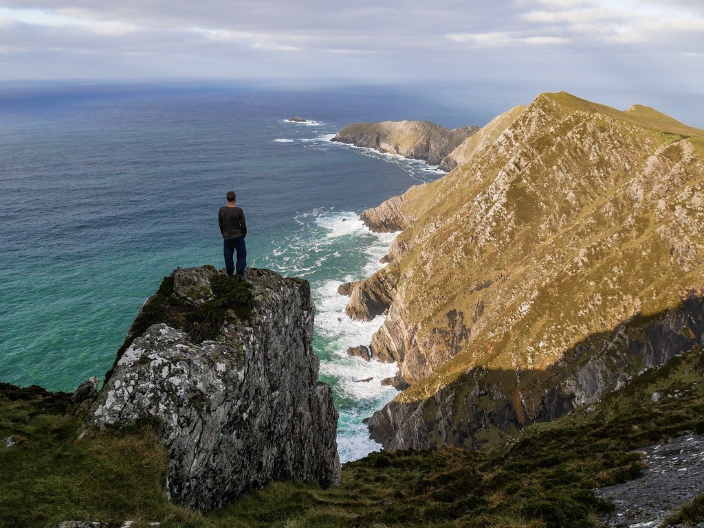
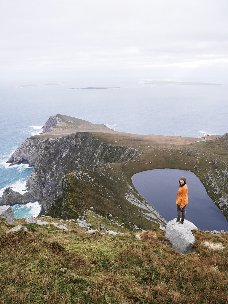
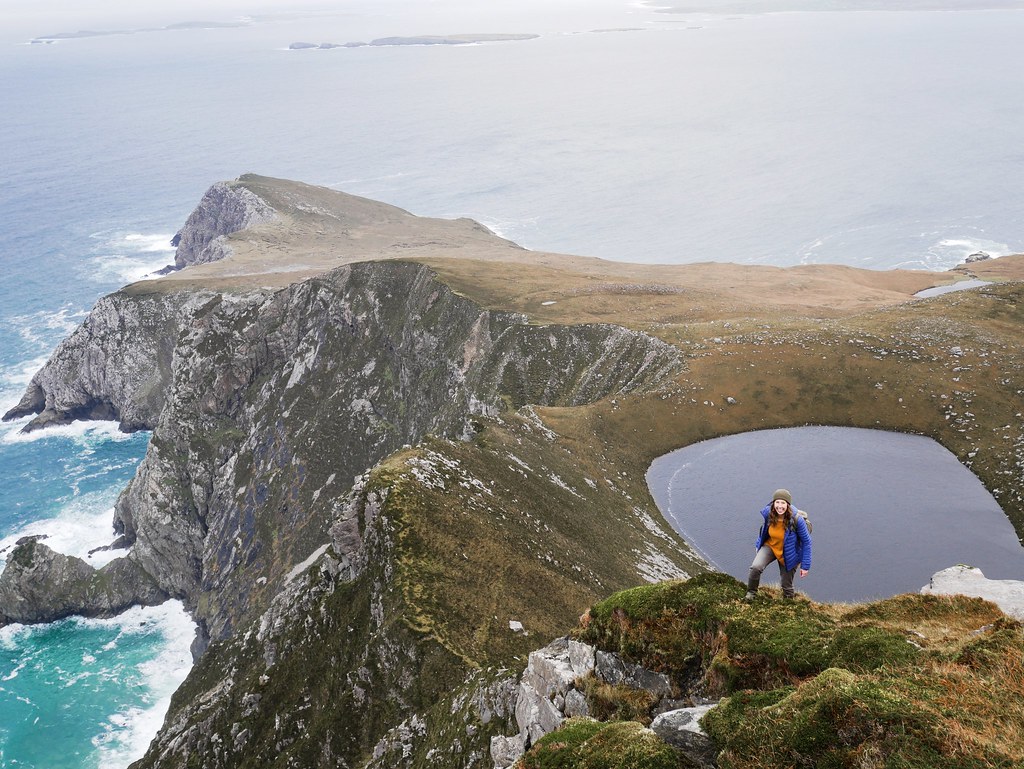
I’d say they weren’t quite as nice to photograph as Slieve League cliffs in Donegal but the sun had long but vanished so maybe that had some effect. Instead of stopping for lunch we continued hiking along the plateau until we were standing high above Bunnafreva Lough West, a dark lake on a headland below us. The headland was lined with jagged cliffs and eroded by the milky blue waves constantly crashing into the walls. The view was pretty damn incredible, in fact I’d say it was more impressive than the main cliffs we came to see. It was a windy spot for lunch and we quickly became cold to the bone. I managed to drop my packet of crisps between some boulders and had to stick my hand into the dark hole to get them which I didn’t enjoy much. I felt like I was in an Irish version of I’m a celebrity, but instead of putting my hand into a box of tarantulas I was terrified that a group of leprechauns were going to grab me.
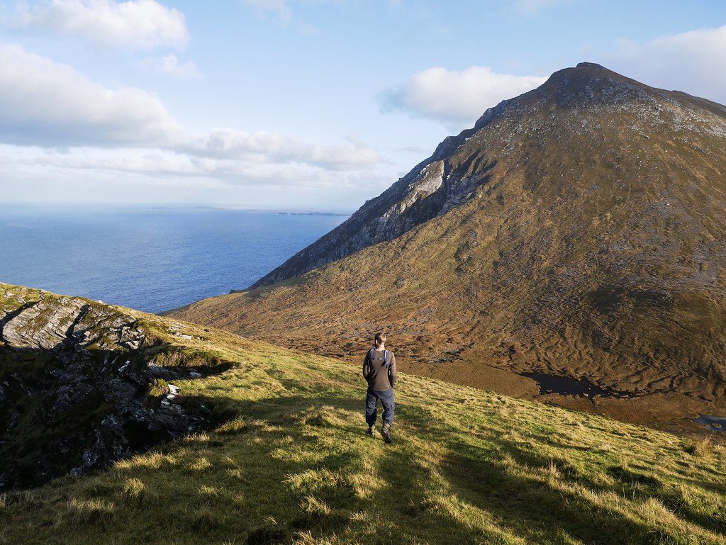


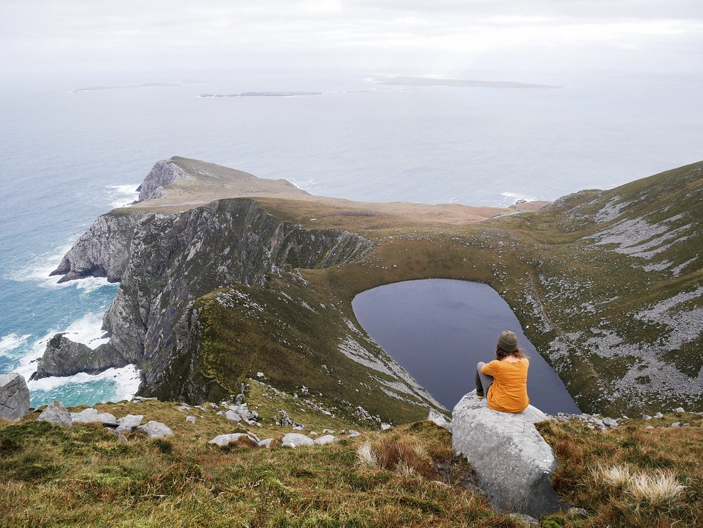

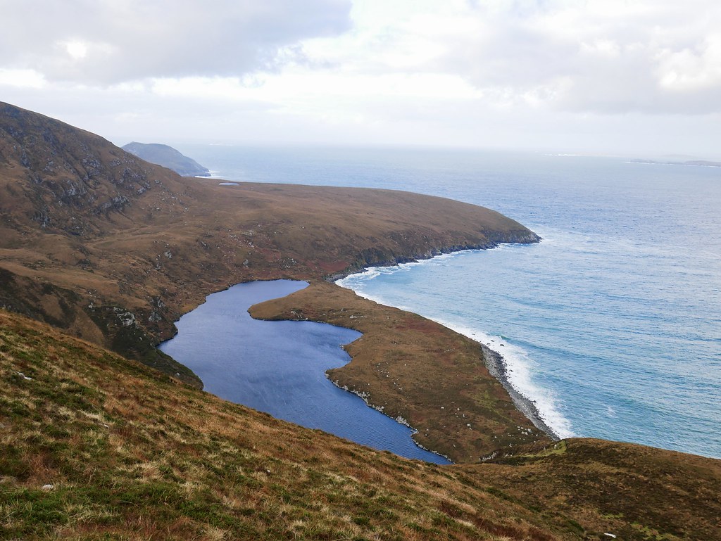
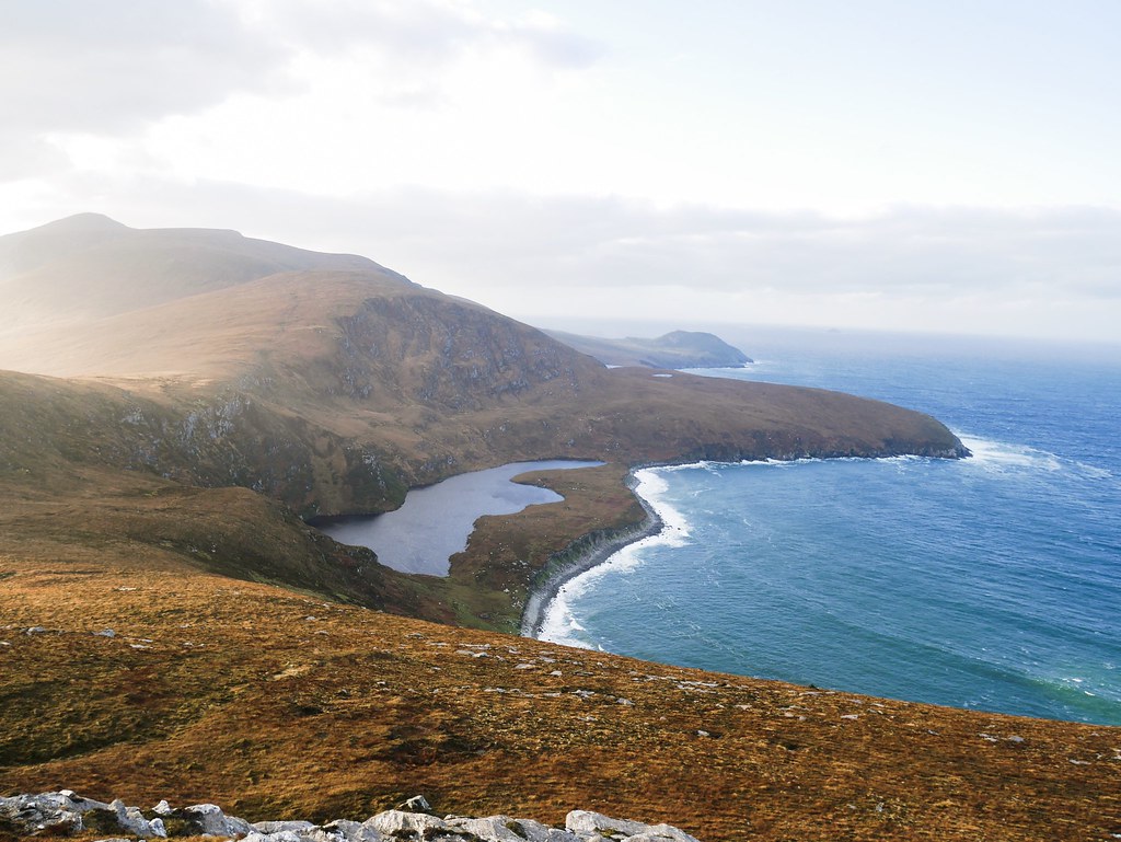
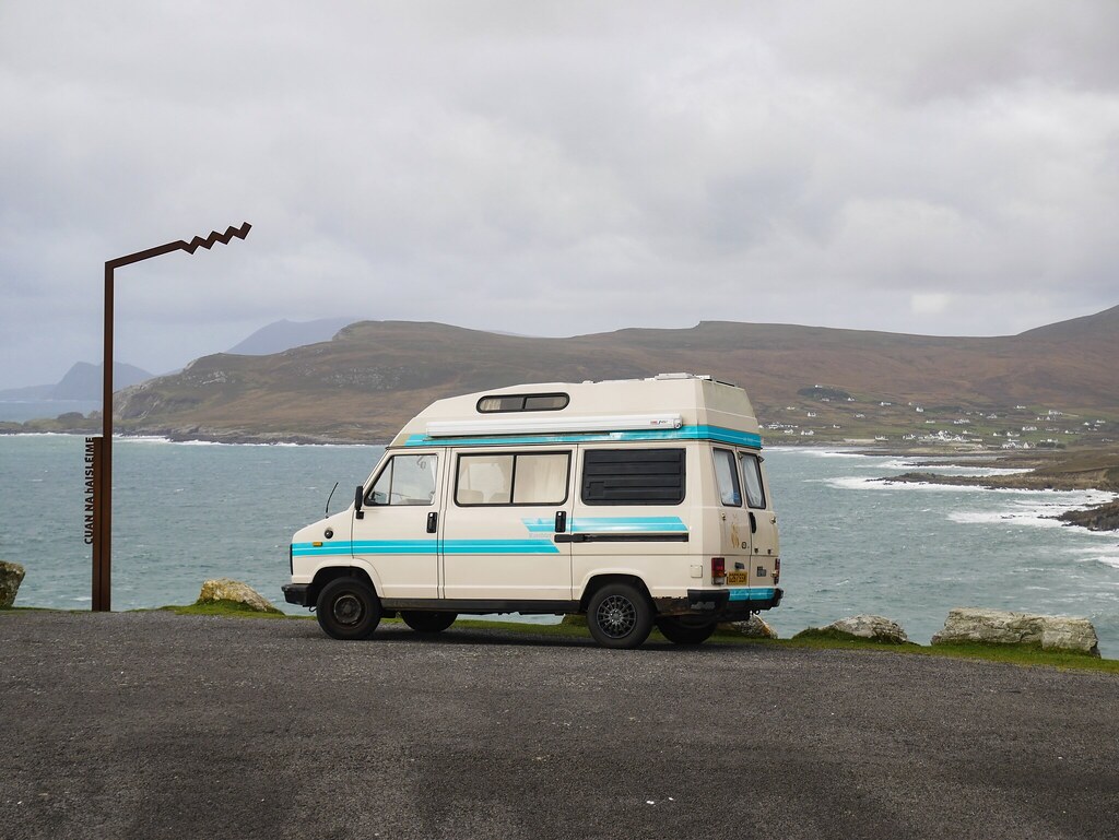
We had a very long walk back, taking a different route across the moorland to Helga, a total of 6 hours hiking by the time we got back. We relaxed in Helga until the sun went down and then we found a place to camp for the night. The weather the next day was miserable with heavy rain and wind so it was basically a right off. We wanted to do another hike in the area so we stayed put and luckily by 3pm the rain began to ease so we were able to head out. Our aim was to hike up a hill which would give us a view of Lough Nakeeroge, the lowest Corrie lake in Ireland at just 16m above sea level. It’s nestled in a sort of cirque above the shores of Annagh Strand beach. After about an hour and a half we were standing atop the hill and being absolutely battered by the wind. It was ferocious, almost knocking us over as we tried to stabilise ourselves on rocks. But it was pretty exhilarating with the wind hitting my face and filling my mouth with air, I looked like a hamster with cheeks full of food. Craig did some more ‘poor man skydiving’ which is a new sport he started in Ireland, leaning into the wind and letting it hold you in the air. The weather really improved and the sun was hitting the rounded mountains and causing the whole landscape to glow in the golden light. We had an amazing view across the whole island including Slievemore mountain which rose out the sea like a volcano.


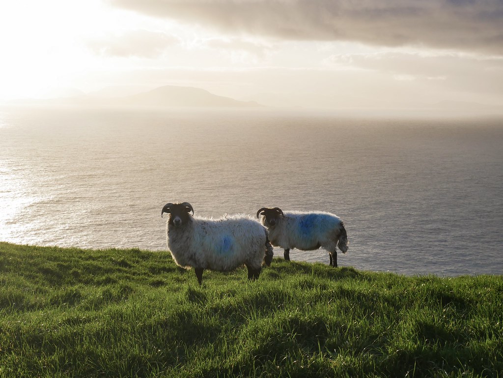
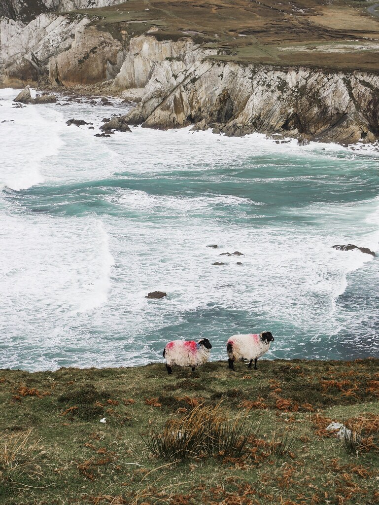
We viewed the other side of Slievemore from Doogort the following morning so we could see it rising impressively above the beach. Then we set off on a scenic drive around the island along the ‘Atlantic Drive’ which is a single track road skirting the rugged coastline so we had the choppy sea crashing below us. We stopped at a view point where some colourful sheep stood on a grassy slope above the white-washed ocean. Further down the road we had to stop again as we got to an amazing stretch where the waves were massive. They were crushing into the cliffs and rocks, causing huge spray up to 20 meters high. We decided to take a closer look and walked onto what’s probably a little island but at low tide we were able to walk across. Craig managed to stand in the wrong place when a huge wave crashed and I watched in slow motion as the water fell from the sky, right onto Craig. The tide came in really quickly and after just five minutes we were starting to lose our access back to land. We were parked up in a wonderful spot to view the violent waves but there was actually too much sea mist around. Our windows quickly became covered in a salty film and we realised it probably wasn’t wise having our rusty van in such a salty environment overnight so we reluctantly set off and found a sheltered harbour car park without a wave in sight.


Stunning, amazing views! It’s a wonderful place.
Thank you! It sure is.