Where is Florence, Italy. Maps, distances and geography
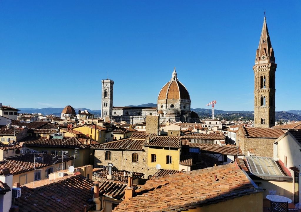
Florence is located in Italy, precisely in the central part of Italy. It is one of the most popular tourist destinations in Europe, thanks to its rich heritage of art, architecture and history. In fact Florence is considered the cradle of the Italian Renaissance, the city where Leonardo da Vinci, Michelangelo and many other great artists lived and worked.
I am a local licensed tour guide in Florence with more than 10 years of experience!
- You can find all my private guided tours in Florence here.
- Here are my tips for visiting Florence.
If your are planning to visit Florence, check my Florence trip planner with all the info and tips you may need.
Now… let’s talk about geography!
Where is Florence, Italy (Europe)
Florence, being in Italy, is located in Europe (the continent), and Italy is part of the EU (European Union as a political and economical union of nations). Italy geographically consists of a peninsula located in southern Europe.
Italy borders France, Switzerland, Austria and Slovenia to the north. The Mediterranean Sea is surrounding the peninsula on all other sides.
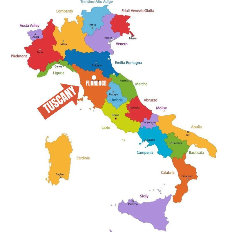
Florence on a map of Italy
Florence is the capital city of Tuscany, which is one of the twenty regions into which Italy is divided. Tuscany is located in central Italy and is bordered by the Mediterranean Sea to the west.
Here is a useful map of the regions of Italy: I have highlighted Tuscany and Florence.
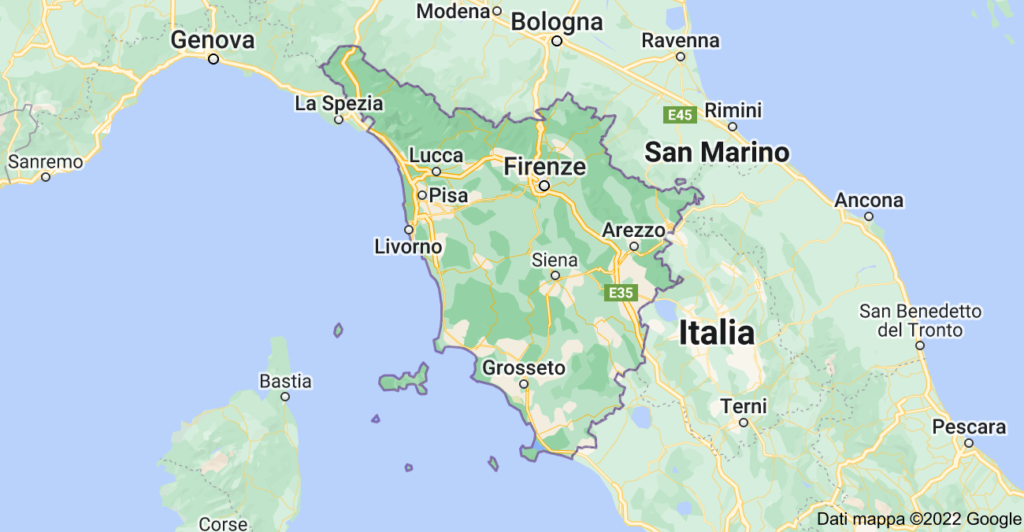
Florence on a map of Tuscany
The city of Florence is located in the middle of Tuscany, about 80 km from the west coast of Italy. The famous rolling hills of Tuscany and the region of Chianti, world known for its wines, are surrounding the city.
Florence is the largest city in Tuscany, but in any case it is not very big: the city has about 380,000 inhabitants.
- Fun fact: did you know that Florence is 13 times smaller than Rome?
Tuscany is the same region in which Pisa, the city of the leaning tower, is located. In fact, the Arno river, which crosses Florence, is the same river that also flows in Pisa. The distance between Pisa and Florence is about 80 km.
Other cities close to Florence and distances
From Florence you can quickly reach many other Italian cities: the country is small and the distances are short. Furthermore, Florence is located in the center and equally close to both the north and south of Italy. It’s also an important road and rail hub for the whole Italy.
You can reach most of the Italian cities by train from Florence in a few hours, or you can rent a car in Florence and take a road trip in Italy.
Here are the distances between Florence and the main Italian cities. Florence is …
- 80 km away from Pisa (1 hour by train or car).
- 80 km away from Siena (1.5 hours by train, a bit less by car).
- 275 km away from Rome. It takes 1.5 hours by speed train, or 3 hours by car.
- 260 km away from Venice. 2.5 hours by train, 3-4 hours by car.
- 110 km away from Bologna. 30 minutes by speed train or 1 hour by car.
- 150 km away from Cinque Terre (La Spezia). You can get there by train (2 hours) or car (2-3 hours).
- 300 km away from Milan. 2 hours by speed train or from 3.5 to 5 hours by car.
- 470 km away from Naples, Sorrento and Amalfi Coast. You can get there by car (4-6 hours) or by speed train (3 hours).
If you are planning a trip to Italy read also…
- What to see on a road trip from Florence to Rome
- Day trip to Cinque Terre from Florence
Is it Florence or Firenze?
The Italian name of the city is Firenze, while Florence is the English translation of Firenze.
The name of the city comes from the latin Florentia, which was maybe inspired by Flora, the goddess of blooming. Or more probably, it was just an auspicious name (florida means thriving).